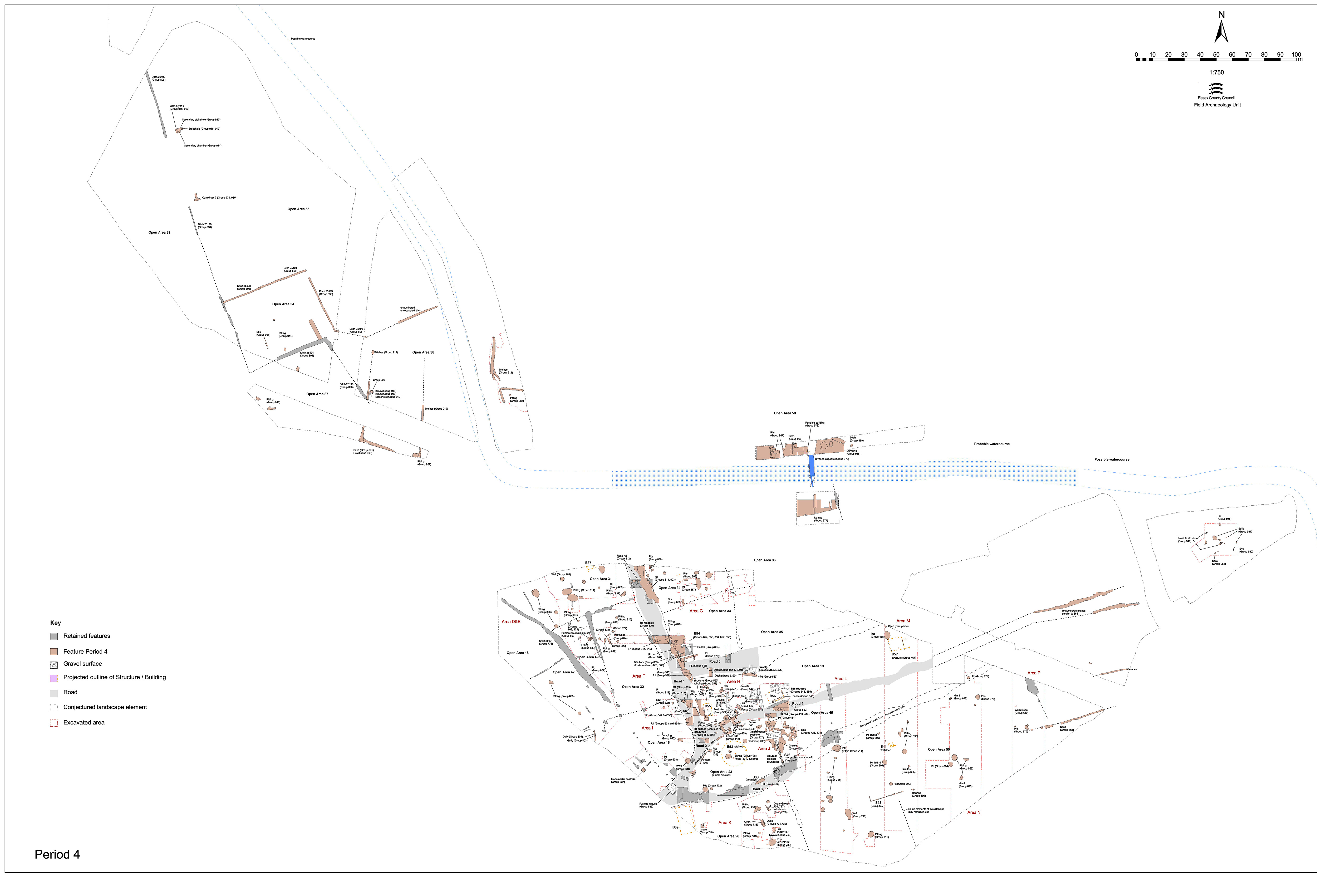
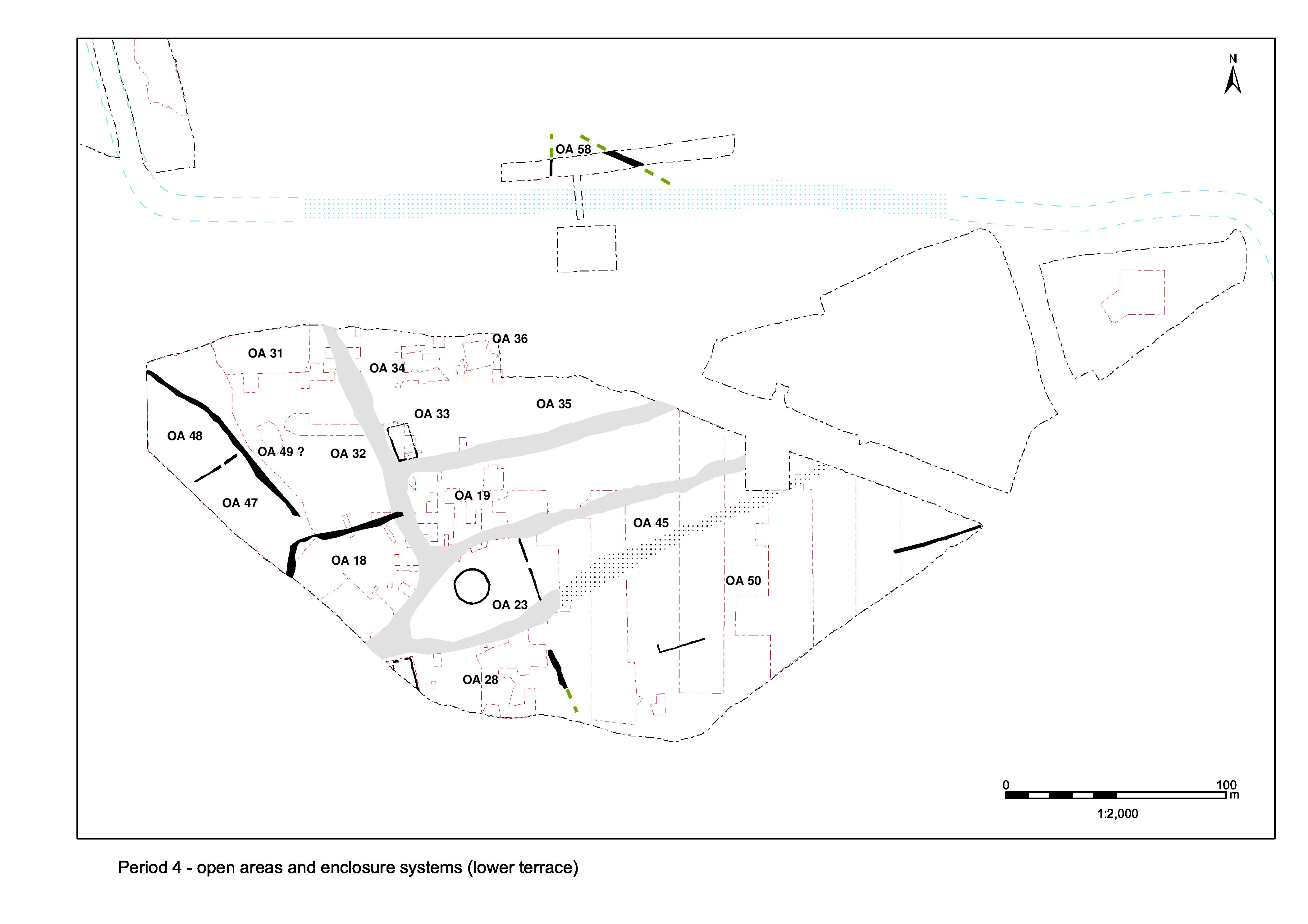
Evidence for further upkeep of Road 5 during the mid-Roman period is only recorded where investigated within/between Excavation Areas G and H. Further east, within Excavation Areas K-Q, no new road deposits or roadside features are apparent and perpetuation of its presumed track-like continuation is wholly construed from lack of encroachment.
Road 5 receives its fourth and final resurfacing in the mid-Roman period. Gravel layer 6446 (Group 541) is a worn surface comprising poorly graded and compacted stones. Dating evidence derives from cleaning layer 6283 over this surface and perhaps suggests that little maintenance is undertaken, even this close to the settlement core, beyond the early 3rd century AD.
Ditch 25259 (segs 6769, 6814) runs along the south side of Road 5, generally offset to its south by some 3m. Excavated segment 6814 defines the shallow, 1.7m wide, western terminal of the ditch, which terminates at the junction of Roads 1 and 5. The ditch deepens as it progresses eastward, being 0.37m deep in segment 6769. It is traced for a distance of 41m and clearly extends beyond the eastern limit of Excavation Area H, though its full extent is not discernible on pre-excavation planning. Only the south side of segment 6313 (Group 4001) is likely to belong to this ditch (see below). The ditch cuts Period 4 gravel surfaces of the interior of OA19 (Groups 515/537) and is itself overlain by a further mid-Roman interior surface 6715 (Group 547).
Ditch 25115 (segs 6358, 6369, 6577), which post-dates the later of the mid-Roman gravel surfaces across the interior of OA19 (Group 547) and a shallow uncertain feature (6762 Group 563), is clearly a replacement for ditch 25259 (Group 539, above), judging by the way it follows its line so closely for much of its length alongside Road 5, departing only as it reaches the Junction of Roads 1 and 5. Most reliably excavated as adjoining segments 6358 and 6369, in the north-east corner of OA19, it is 1.6m wide and 0.6m deep. The status of ditch segment 6313 (Group 4001) is ambivalent, but its northern part almost certainly represents the westward continuation of 25115. At least one episode of re-cutting is apparent in the excavated segments. It is likely that the ditch continues to function, or at least to accumulate material in its top, into the 4th century AD.
It is postulated that ditch segment 6577, immediately alongside the Road 1/5 junction, represents the southward return of this same roadside ditch down the eastern side of Road 1. Its extent along the Road 1 frontage is undetermined.
There is the question whether 25259 and 25115 constitute actual roadside ditches or enclosure ditches - particularly when the incidence of gully/post-hole fencelines along the north side of Road 4 (Groups 545, 557) is considered. However, the fact that such boundary features run alongside Roads 5 and 1 help demonstrate that the roads remain active.
Internet Archaeology is an open access journal based in the Department of Archaeology, University of York. Except where otherwise noted, content from this work may be used under the terms of the Creative Commons Attribution 3.0 (CC BY) Unported licence, which permits unrestricted use, distribution, and reproduction in any medium, provided that attribution to the author(s), the title of the work, the Internet Archaeology journal and the relevant URL/DOI are given.
Terms and Conditions | Legal Statements | Privacy Policy | Cookies Policy | Citing Internet Archaeology
Internet Archaeology content is preserved for the long term with the Archaeology Data Service (ROR). Help sustain and support open access publication by donating to our Open Access Archaeology Fund.