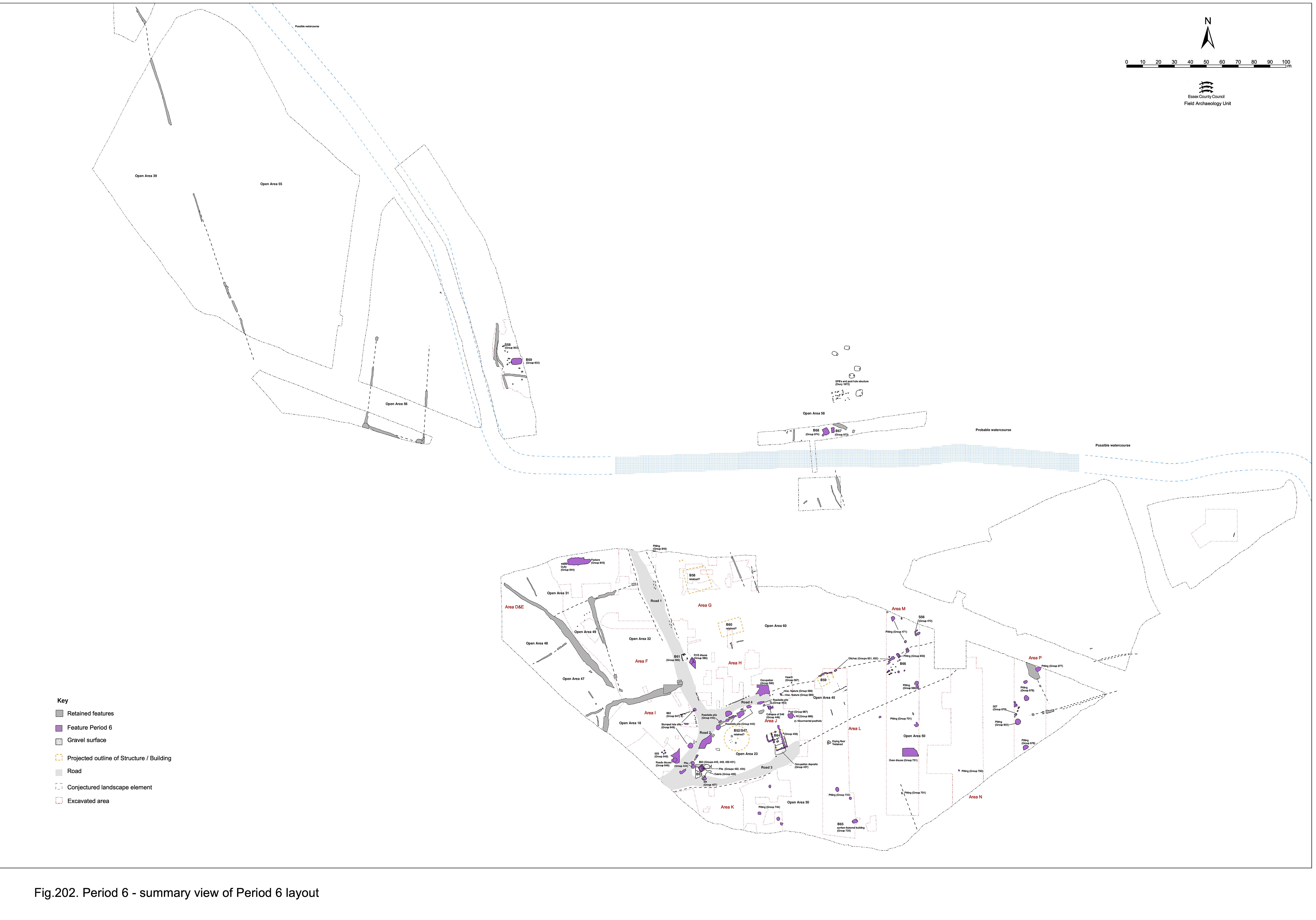
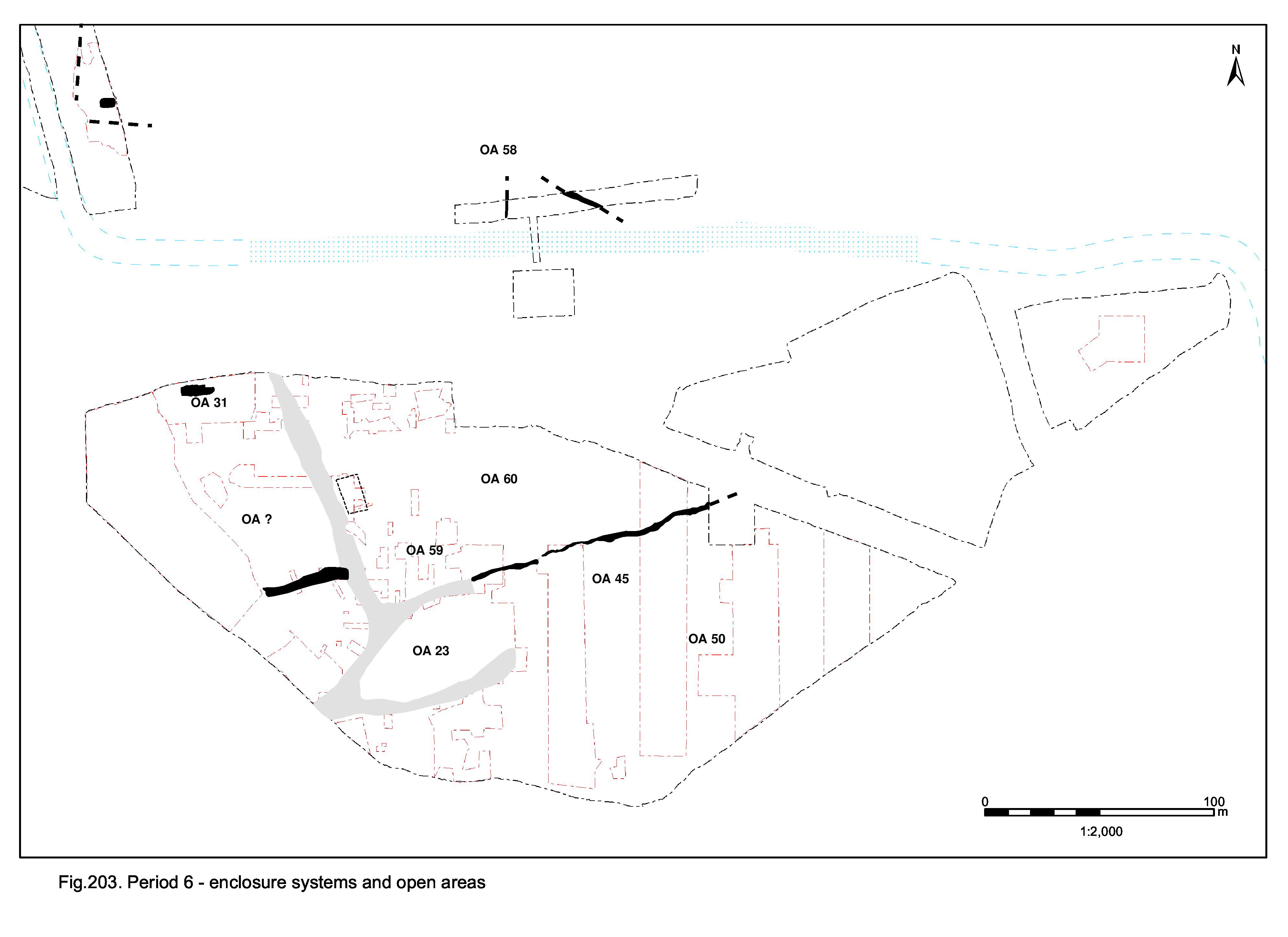
Although side Roads 3, 4 and 5 are surely defunct as thoroughfares by the later 4th century, if not before, the active use of Road 1 is assumed to persist to the end of the Roman period (Figure 203). This continuance does not apparently involve any upkeep. Indeed, all the former roads are increasingly encroached upon by accumulating silts that demonstrate either increasing neglect or abandonment. Road 1, and by inference Road 2, finally cease to function sometime in the 5th century when a building is opportunistically sited on the convenient hardstanding provided by the junction of the Roads 1 and 5 remnants.
The imposition of Building 61 on Road 1 at its junction with Road 5 is the only firm indicator of its Period 6 demise. Some of the silt accumulation upon it may in fact form in the late 4th century or subsequently.
Parts of the Road 2/3 junction, as well as the northern roadside and adjacent part of Open Area 18, are overlain by accumulations of silts (5502, 5851, 5839, 5840 Group 646), indicating that the road is neglected. Dated by their latest pottery these layers belong to the late 4th century AD, but it is possible they begin accumulating earlier and develop slowly or that the latest sherds (almost always more abraded) are intrusive (e.g. 5851).
There is no identified use or disuse of Road 3 dated to Period 3.
A sequence of dark sandy silts (5148, 5153, 5159, 5227, 5228, 5275, 5305, 5306, 5307, 5401, 5409, 5413, 5414, 5453, 5543, 5580, 5605 Group 457) overlie both the features along the northern edge of the temple precinct (OA23) and the adjacent latest Road 4 surfaces. These date to the late 4th century or later. While some may be the upper portions of the underlying features (see Central zone, Open Area 23), some are likely to be silting and roadwash. Further east, post-holes, or possible small votive pits (Groups 588, 589), again extend from the interior of OA45 onto the line of Road 4 and provide a further example of encroachment onto the defunct thoroughfare.
Within adjacent Open Area 60 and extending onto Road 4, gravelly soil 6008 (Group 590), is the latest of the essentially homogeneous deposits that accumulate here. Its gravel component may derive from the deterioration of underlying gravel surfaces. Further discussion of this deposit and of the significance of the Saxon pottery sherd it contains is presented in Central/Northern zone, Open Area 60.
Overlying the junction of Roads 1 and 5, and extending into the adjacent interior of Open Area 60, layers of gravelly silt 6742, 6755, 6786, 6895 (Group 586) may possibly be degraded surfaces in their own right, but are more likely a mixture of road-wash and silt accumulation.
Internet Archaeology is an open access journal based in the Department of Archaeology, University of York. Except where otherwise noted, content from this work may be used under the terms of the Creative Commons Attribution 3.0 (CC BY) Unported licence, which permits unrestricted use, distribution, and reproduction in any medium, provided that attribution to the author(s), the title of the work, the Internet Archaeology journal and the relevant URL/DOI are given.
Terms and Conditions | Legal Statements | Privacy Policy | Cookies Policy | Citing Internet Archaeology
Internet Archaeology content is preserved for the long term with the Archaeology Data Service (ROR). Help sustain and support open access publication by donating to our Open Access Archaeology Fund.