Fig.1: Brough-on-Humber in its context (clickable map)
The Roman settlement at Brough-on-Humber | Previous archaeological investigations | The Welton Road site | Post-excavation methodology
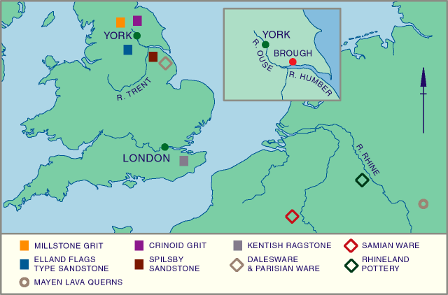
The small Roman town of Brough-on-Humber is situated close to the north bank of the Humber estuary, 18km from Kingston-upon-Hull and 44km south-east of York. During the Roman period the town was well situated on the main road south from the Roman town at York (Eboracum), and at the northern end of the ferry route across the Humber that carried the route southwards to Lincoln (Lindum).
Fig.1: Brough-on-Humber in its context (clickable map)
To the west of Brough is the low-lying area of Walling Fen, where there is evidence for Roman occupation in the form of enclosed farmsteads (Millett and Halkon 1988), though the area remained wet, with seasonal flooding. As well as evidence for agricultural production the area has also produced evidence for industrial activities, including pottery kilns at Bursea House, Throlam and Tollington (Corder 1930), and iron-working at Welham Bridge (Millett and Halkon 1988, 43). On the other side of Brough, to the east, is the important late pre-Roman Iron Age site at Redcliff. Although Redcliff shows a floruit of Roman activity in the Claudio-Neronian, decline sets in rapidly, following the establishment of an alternative river crossing, probably at Brough c.AD71.
Brough is an important site as it is one of the few Roman urban sites known in East Yorkshire. The other possible sites are the roadside settlement at Shiptonthorpe, and the Roman fort and vicus at Malton. Shiptonthorpe is situated 20km north of Brough, along the main Roman road to York. Survey work has shown substantial evidence for occupation, covering an area of up to 20 hectares (Taylor 1995). This may well be the Roman town listed on the Antonine Itinerary as Delgovicia (Millett and Halkon 1988, 39, though see Creighton 1988). Malton, north of the Yorkshire Wolds, straddles the river Derwent. Originally the site of a Roman fort, a thriving vicus soon developed at the adjacent site of Norton.
Malton, Shiptonthorpe and Brough were all located within the territory of the Iron Age tribe the Parisi (Ramm 1978), who occupied East Yorkshire at the time of the Roman conquest. Their territory is probably reflected by the highly distinctive cemeteries of the Arras culture. These clusters of square barrows are distributed widely across the chalk uplands of the Yorkshire Wolds, and several more have been identified on the southern slopes of the North Yorkshire Moors.
Brough's position on low-lying land on the banks of the Humber greatly influenced its development. It may owe much of its importance to its role as ferry point and supply depot, making good use of its position on the north-south route from Lincoln to York, as well as having easy access to the riverine communication routes flowing westwards along the Humber and its tributaries, the Ouse and the Trent, providing easy access to much of the east midands. It could also take advantage of the maritime supply routes running along the east coast of Britain. However because of its low-lying position it was vulnerable to flooding, and it is probable that flooding brought about a terminal decline in the settlement during the later 4th century (Ramm 1978, 58f).
There are hints of late pre-Roman Iron Age occupation at Brough, but the first major construction at the site was a Roman fort, with two phases of occupation. This fell out of use c.AD 125 and was replaced by a walled settlement surrounded by a turf and timber rampart, which was later replaced by a stone wall with external bastions during the later 3rd and early 4th century.
The function of the post-fort occupation at Brough is controversial. It is often assumed to be the civitas capital of the Parisi, perhaps taking this role over from the Pre-Roman Iron Age settlement at Redcliff. This interpretation is based on the discovery of a stone inscription dedicating a theatre (RIB 707), which refers to the vicus Petuariensis; Brough is usually identified as Petuaria. The name Petuaria is thought to be derived from a root meaning ‘four', and may mean that it was the vicus of the fourth pagus of the Parisi. Although the inscription refers to Brough as a vicus not a civitas, it is clear that the dedication was ordered by an aedile, suggesting civitas status: a vicus would normally only possess magistri. Based on this Ramm has suggested that Brough was the civitas capital of the Parisi, although there is no evidence that Petuaria was awarded a tribal suffix as would be expected of such a site and is found at other civitas capitals such as Calleva [Atrebatum] (Silchester) and Venta [Belgarum] (Winchester).
John Wacher has strongly opposed this view. He contrasts the early appearance of masonry domestic or industrial buildings, usually a late Roman phenomenon, with the complete lack of other indicators of urban sophistication, such as public buildings or a planned street system (Wacher 1995, 394-8). It is also unusual for a town to be enclosed so early, and its turf and timber ramparts have more in common with contemporary military works than later town defences (Wacher 1969, 32). Currently the status of the site is unresolved, but it is hoped that these excavations may contribute to clarifying the matter.
© Internet Archaeology
URL: http://intarch.ac.uk/journal/issue9/brough/intro1.html
Last updated: Tue Nov 28 2000