Other than a scatter of unstratified artefacts, there are no features of medieval date (i.e. 6th-16th centuries) post-dating the abandonment of the Roman and Early Saxon settlements.
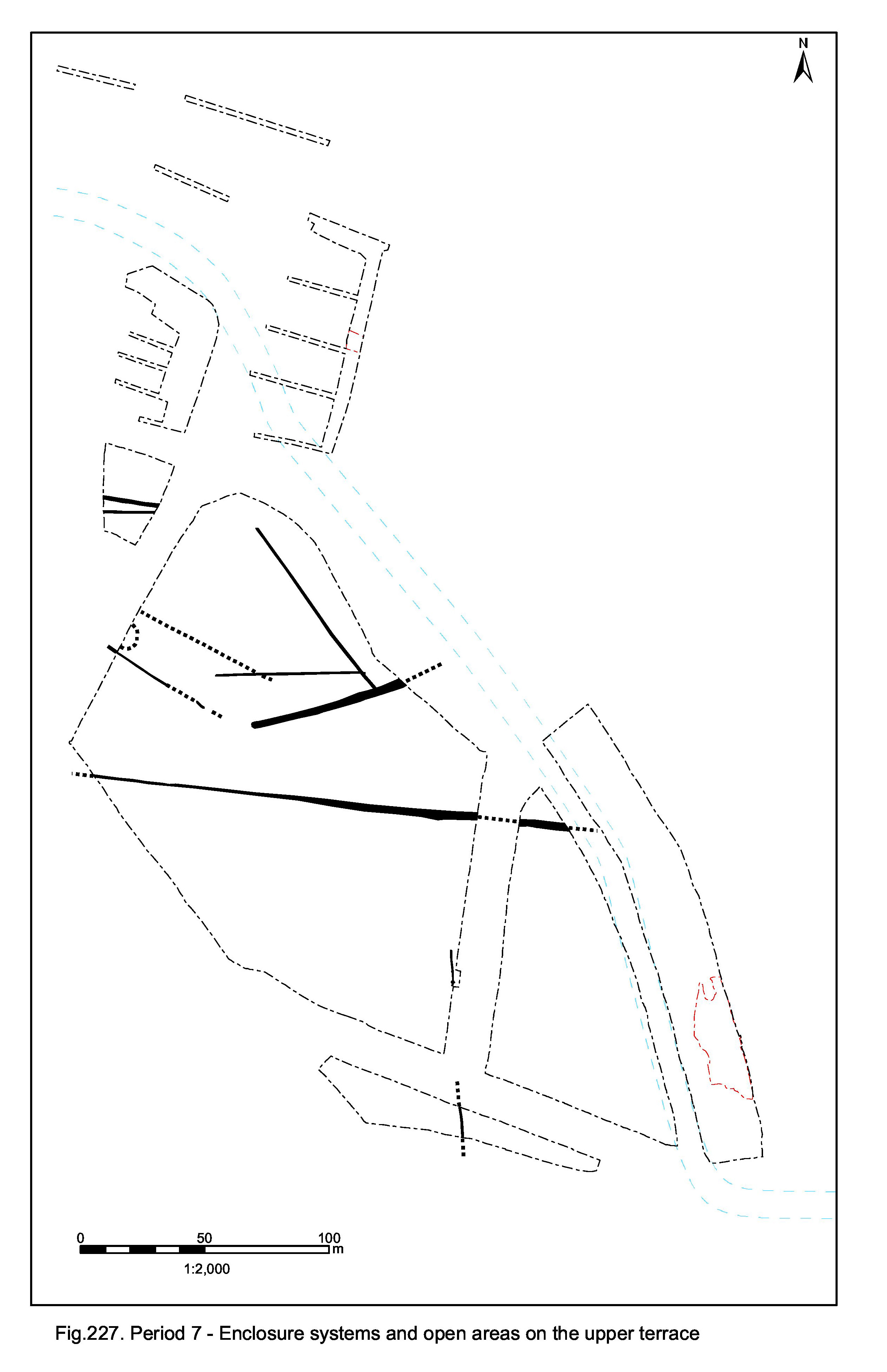
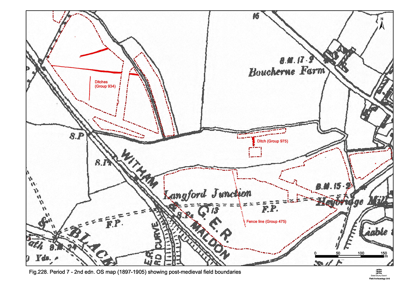
Cartography provides the basis for evidence of post-medieval land-use and shows that the field system dates to the 18th century or earlier and survives largely unchanged into the late 20th century. By the time of the 1st edition OS map (1881) the Elms Farm site area is wholly enclosed farmland (Figure 228). Within the site (Development Areas A to C), the lower terrace is divided into the four fields that remained extant to the point of its development, although these already suffered disruption, first by the Chelmer and Blackwater Navigation (constructed 1793-7) and then by the Witham and Maldon Branch of the Great Eastern Railway (constructed 1848).
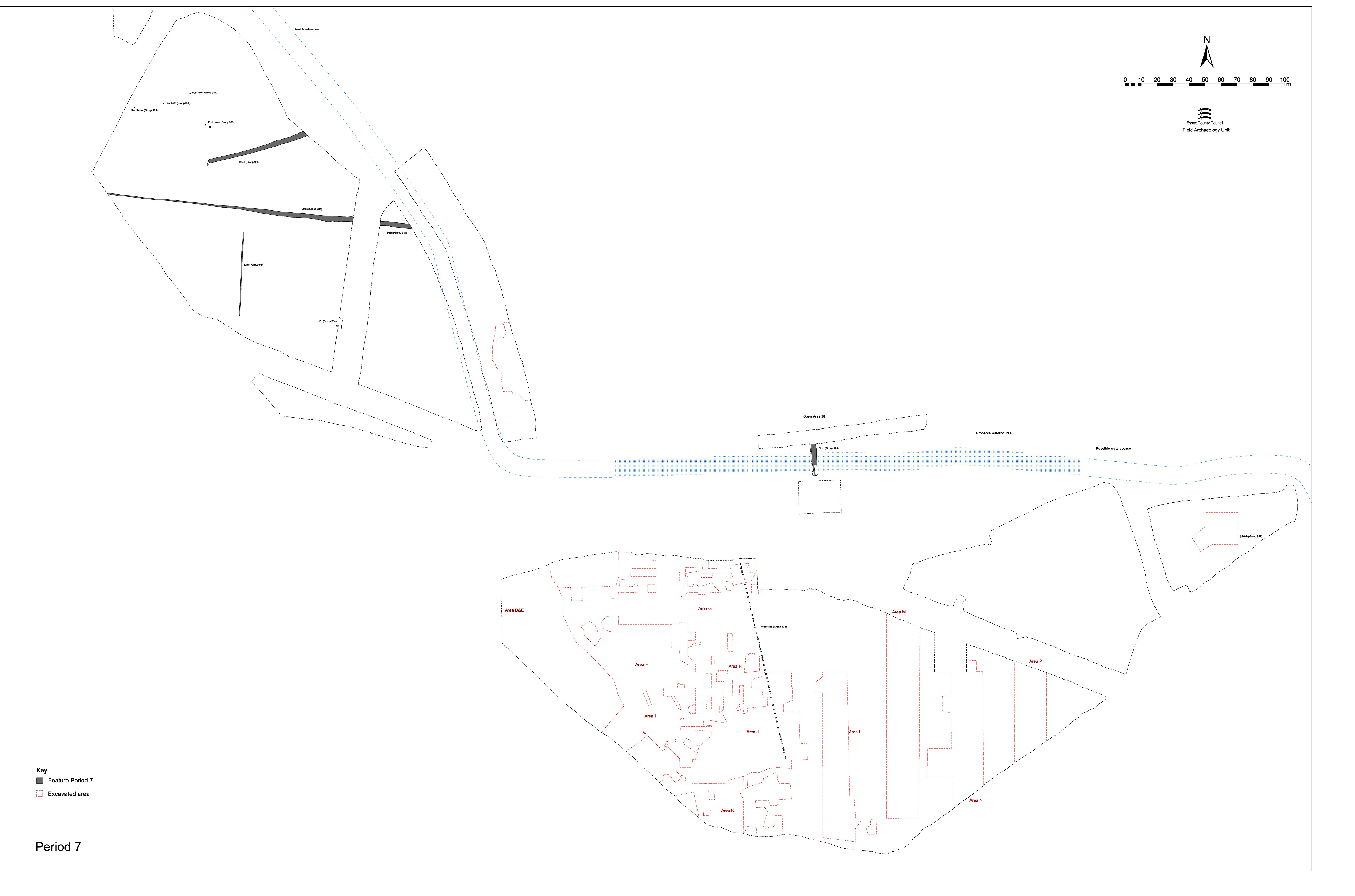
The recorded archaeological remains of the post-medieval land-use of the lower gravel terrace are described below and their location/distribution shown on Figure 226.
A NNW-SSE fenceline of sixty-four recorded post-holes runs across the eastern limit of Excavation Areas G, H and J, coincidentally the boundary between Development Scheme Areas A1 and A2. The post-holes are the latest stratigraphic features encountered, visibly cutting the Late Roman layers that cover much of the area and also the surfaces of Roads 3, 4 and 5. The post-holes are all square to sub-square, vertically sided and 0.35-0.5m deep and mostly set at fairly regular intervals of 1-2m. However, some are positioned immediately adjacent (e.g. 7038 and 7035) and others are inter-cutting (e.g. 7022 and 7046), which presumably denotes repair and replacement of the fence.
Although containing a range of material of intrinsic Late Iron Age to Early Saxon date, the presence of post-medieval tile fragments in post-holes 6068, 6087, 6092 7002, 7008 and 7027 reveals this to be wholly residual. Furthermore, the survival of stumps of in situ posts in a few of the pits (7008, 7022, 7035) would seem to confirm their relatively recent date.
Extending for a recorded distance of c. 128m, it is assumed that the line continues across Excavation Area K. As such, this post-hole alignment represents a fenceline that extends between the hedged and ditched field boundaries to north and south, more-or-less bisecting the field. However, no such boundary is depicted on the OS 1st edition or subsequent mapping.
A spread of such tile was noted during machine stripping, principally in the vicinity of post-holes 6068 and 6092. It is speculated that these two post-holes mark the position of a gateway through the fence which, due to the passage of animals though it and to the soft nature of the ground underfoot created by the presence of underlying ditches 25259 and 25115, required consolidation. The posited location of this gateway coincides with the route of an east-west path across the middle of the field shown on the 1st edition OS map.
It is remarkable that this post-medieval fenceline so closely follows the NNW-SSE alignment of the preceding and long-defunct Roman boundaries of OAs 23 and 59, and perhaps even OA28. While it is tempting to speculate that there may be some indication of former land-division that somehow endures the centuries, no evidence for this is apparent. However, according to local residents, this field has been called 'Stoney Field' in the more recent past - which may allude to encountering the precinct wall foundations or Roads 3, 4 and 5 during cutting some of these very post-holes. Some mention of a short-lived attempt to undertake its arable cultivation during World War 2 was also mentioned.
Area G: 7002, 7004, 7006, 7008, 7012, 7014, 7017, 7019, 7022, 7023, 7027, 7032, 7033, 7035, 7038, 7041, 7046, 7049, 7056, 7313, 7314
Area H: 6004, 6009, 6011, 6013, 6015, 6017, 6021, 6023, 6027, 6051, 6068, 6073, 6087, 6092, 6094, 16105, 16111, 16114, 16127, 16151, 16247, 16165, 16286, 16438, 16453
Area J: 18770, 21533, 21547, 21601, 21685, 21699, 21701, 21713, 21717, 21792, 21807, 21940, 21954, 21994, 22002, 22027, 22070
Large north-to-south aligned ditch 25182 (seg. 17179) delineates the eastern extent of the post-medieval field system across the lower terrace, its imposition pre-dating that of the Chelmer and Blackwater Navigation. The ditch fills contain 19th and possibly early 20th-century rubbish.
Observation during machine stripping of Development Area A4 identified the highly disturbed, possibly redeposited or infilled, nature of the land directly to the east of ditch 25182. This material was largely mechanically removed to a depth of at least 0.7m when underlying natural gravel was reached. No traces of earlier archaeological remains survived below. It was proposed at the time that this represented a possible brickearth quarry subsequently infilled with silts containing 19th and early 20th-century rubbish. However, the 1st edition 25" OS map records the presence of the open ditch and what seems to be a series of regular allotment-like cultivation plots - in essence, located to the rear of the properties along Langford Road. It seems more likely, therefore, that the disturbance and deposition of late artefacts is in fact the result of cultivation activity.
Internet Archaeology is an open access journal based in the Department of Archaeology, University of York. Except where otherwise noted, content from this work may be used under the terms of the Creative Commons Attribution 3.0 (CC BY) Unported licence, which permits unrestricted use, distribution, and reproduction in any medium, provided that attribution to the author(s), the title of the work, the Internet Archaeology journal and the relevant URL/DOI are given.
Terms and Conditions | Legal Statements | Privacy Policy | Cookies Policy | Citing Internet Archaeology
Internet Archaeology content is preserved for the long term with the Archaeology Data Service (ROR). Help sustain and support open access publication by donating to our Open Access Archaeology Fund.