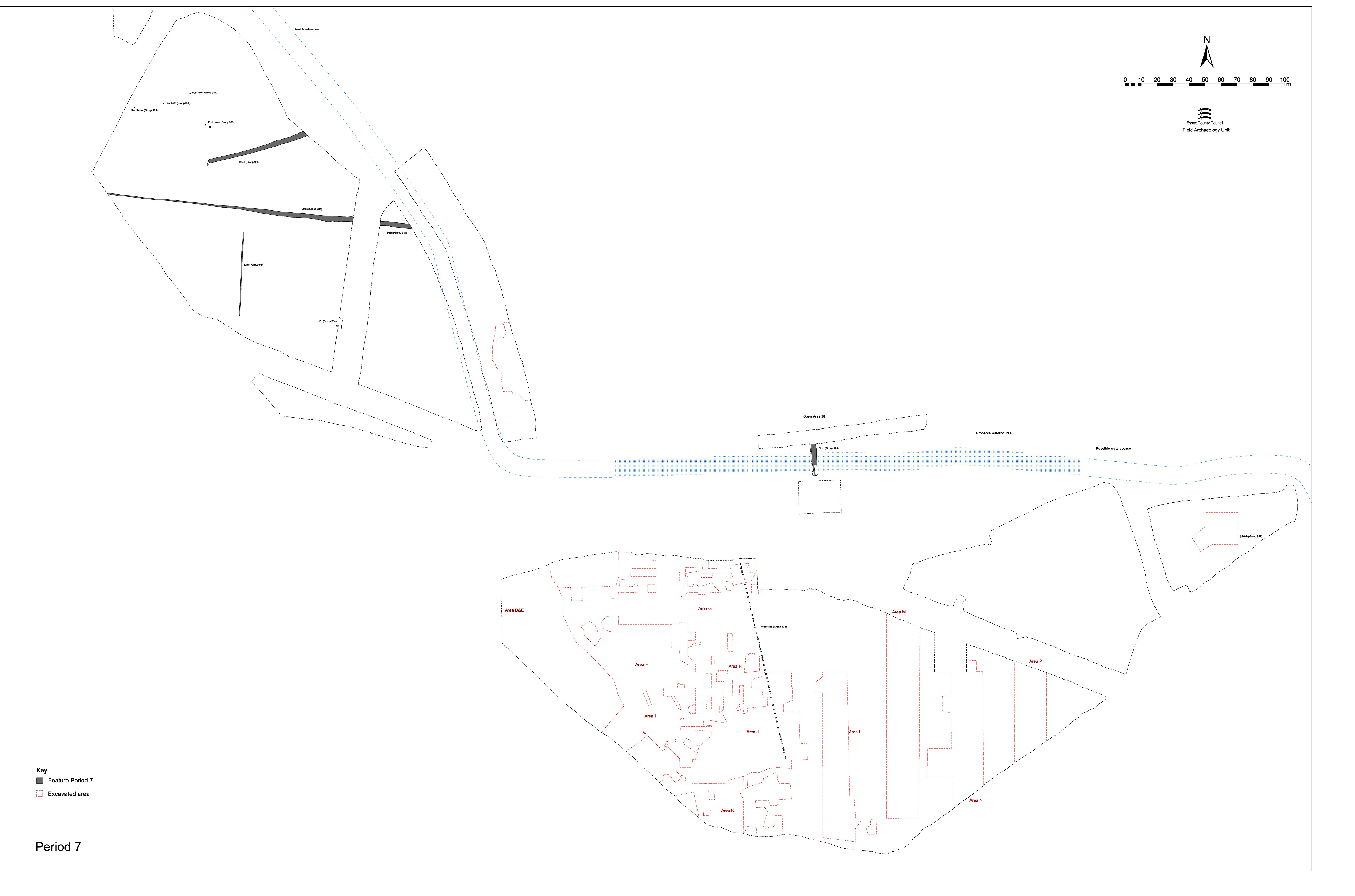
This section describes the archaeological evidence for post-settlement activity across that part of the landscape formerly referred to as the Northern hinterland east of Road 1, Excavation Area R north, OA58, watercourse north bank, etc. Evidence of land-use activity beyond the 5th century AD is very slight and limited to a single large pit or ditch 12175 and deposit 12162, both of which are located at the top of the river channel sequence (Figure 226).
It is perhaps interesting to note that the 19th-century gravel quarrying present on the nearby Crescent Road site (Wickenden 1986, 17) is absent in Area R. It would appear that such extraction did not encroach beyond the edge of the upper gravel terrace.
Large cut 12175 was revealed only in the section of the machine-cut trench across the watercourse. It is located on the very edge of the watercourse, truncating the interface between the dumps of the north bank and the accumulations within the channel itself. As exposed in section, this feature is 2.1m wide and 0.85m deep. While no artefactual material was collected from its fills, building debris was noted to be present in what appeared to be a re-cut and pottery was present throughout. The top of wooden upright 12126, which belongs to the postulated Period 3 watercourse revetment, was encountered in the base of the cut; whether the post was itself truncated by the digging of this pit/ditch, or had already rotted down as far as the water-table, is unknown.
Although possibly a ditch running parallel with the watercourse, it was not traced beyond the confines of the trench. While it is possible that it was a Late Roman or Early Saxon cut, which either followed, or was associated with the robbing of, the postulated Period 3 revetment, this feature is more likely an incidentally sited post-abandonment period pit.
Revealed only in section, deposit 12162 is a layer of brick, tile and plaster or mortar within which early 20th-century ironwork and bottles are noted. Of variable thickness, this spread of dumped material occupies undulations in what is presumed to be the contemporary surface of the field. Its spread also coincides with the middle of the defunct watercourse and what was still the lowest-lying part of Development Area B). It was also noted during the initial stripping of Excavation Area R that such rubble was deposited along the length of the field. This material therefore appears to be a modern attempt to counter the boggy nature of the field surface.
Although not discerned during site investigation, historic mapping evidence indicates that the Development Area B field was formerly subdivided into a number of smaller plots.
Internet Archaeology is an open access journal based in the Department of Archaeology, University of York. Except where otherwise noted, content from this work may be used under the terms of the Creative Commons Attribution 3.0 (CC BY) Unported licence, which permits unrestricted use, distribution, and reproduction in any medium, provided that attribution to the author(s), the title of the work, the Internet Archaeology journal and the relevant URL/DOI are given.
Terms and Conditions | Legal Statements | Privacy Policy | Cookies Policy | Citing Internet Archaeology
Internet Archaeology content is preserved for the long term with the Archaeology Data Service (ROR). Help sustain and support open access publication by donating to our Open Access Archaeology Fund.