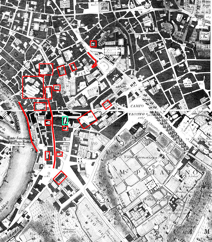
Figure 2: The area of demolition in the Nolli map (see Figure 6), with the clickable areas for which additional information is available (from Frutaz 1962, plates 407, 410).

The site of S. Omobono was discovered in 1937 during a period of extensive redevelopment in the area of the river harbour of ancient Rome (traditionally called Forum Boarium). Since 1870, the Kingdom of Italy and then the Fascist regime had been intent on eliminating much of the medieval and Renaissance fabric throughout the centre of the city (on this global urban transformation, evocatively termed 'sventramento' (disembowelling), envisioned already in the 1873 master plan of Rome: Insolera 1971, 35-59; Cederna 1980, 144-57; Insolera 1981, 369-80; Benevolo 1985, 31; Manacorda and Tamassia 1985, 170-80). Their general purpose was to create a new infrastructure of broad roads, piazzas and monumental buildings, while at the same time exposing the Roman Imperial remains that were often preserved under the structures that were being torn down. In the area of the Forum Boarium, the specific aim was to transform what had long been a residential and light-industry area into the new administrative centre of the city government. This section provides one of the first complete surveys of the urban renewal of this area and of the archaeological discoveries made in the process, which, given the nature of the work, were never published in any detail. Accounts of the work carried out at each location in and around the Forum Boarium can be accessed by clicking on hotspots in the general map (Figure 2), or by selecting one of the entries in the accompanying list.
Figure 2: The area of demolition in the Nolli map (see Figure 6), with the clickable areas for which additional information is available (from Frutaz 1962, plates 407, 410).

List of locations
© Internet Archaeology/Author(s)
University of York legal statements | Terms and Conditions
| File last updated: Mon Mar 12 2012