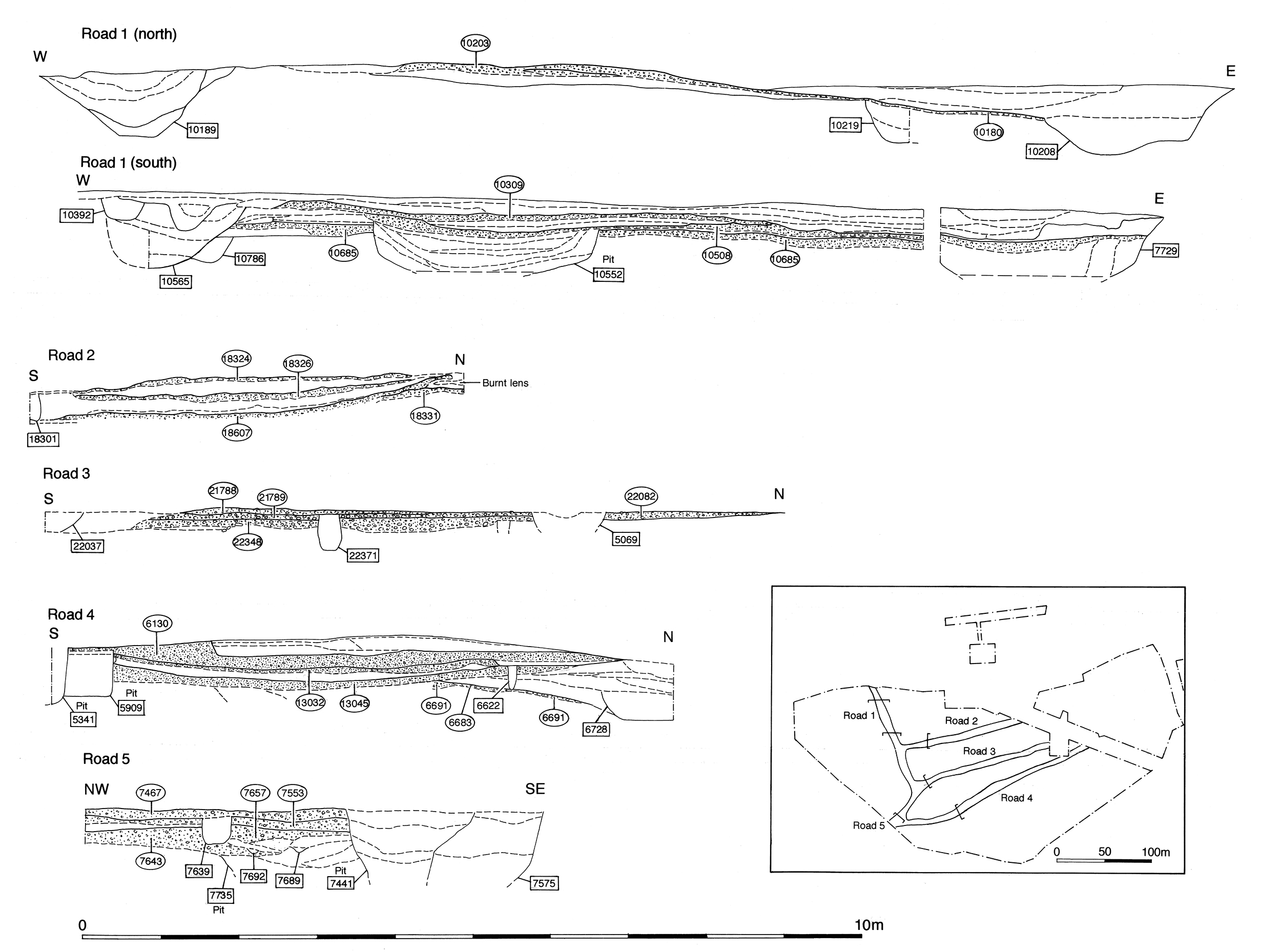
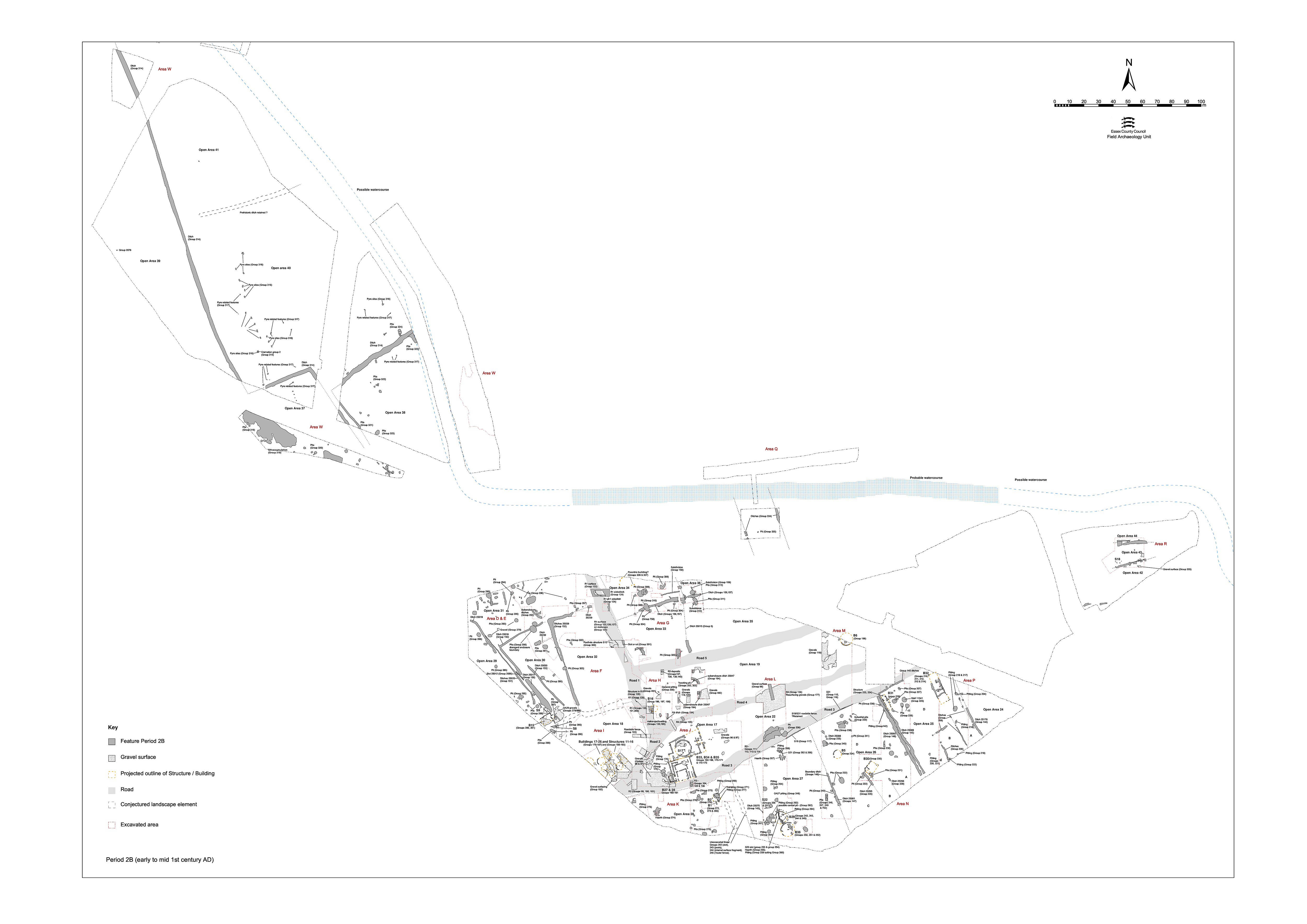
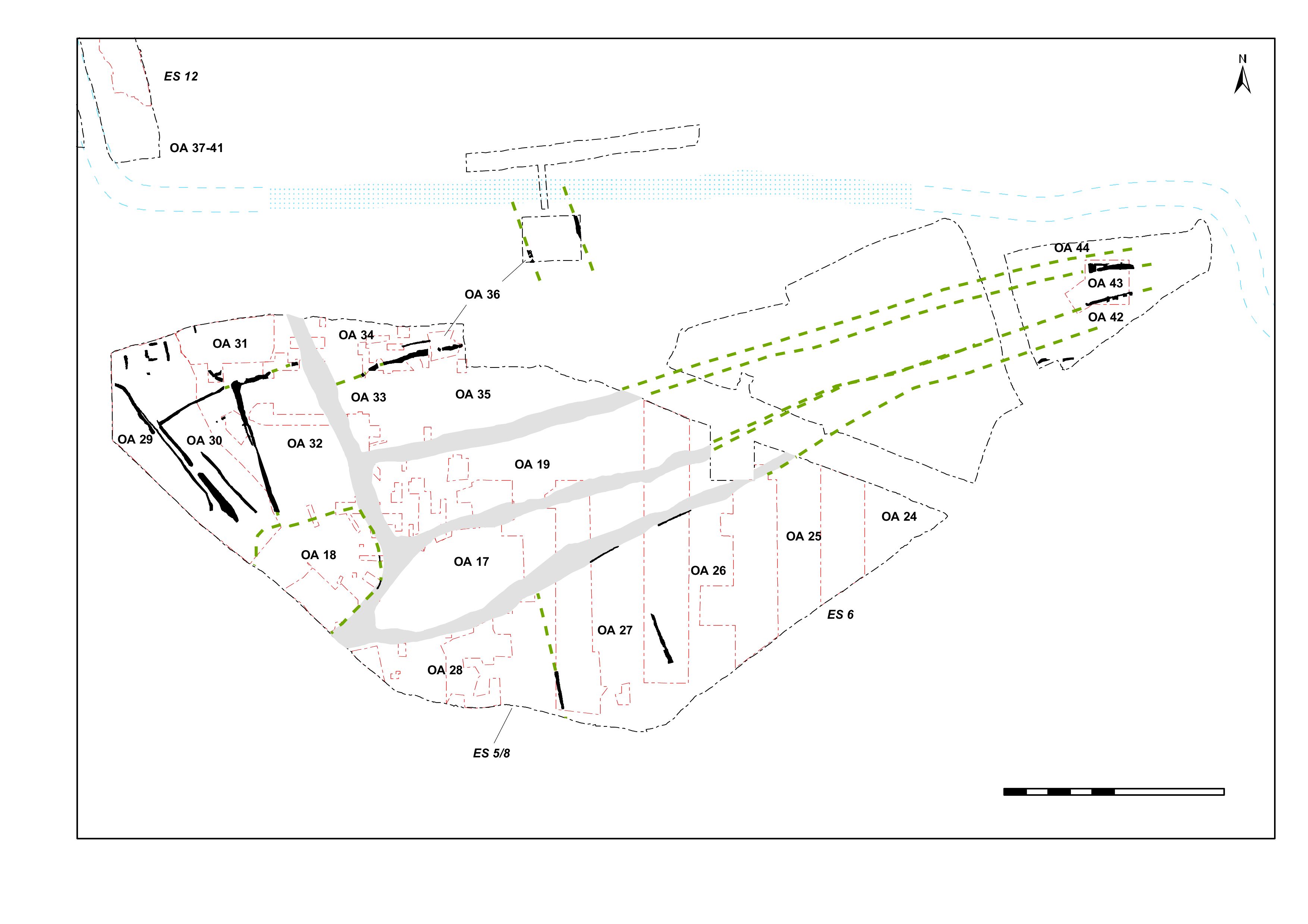
Road 3 (Figure 6 and Figure 58), runs eastwards from its junction with Road 2 and, along with Roads 4 and 5, constitutes one of a series of roughly parallel side roads running away from the main through-route.
Investigated over relatively small areas within Excavation Areas J, K, L and M, its various Period 2B make-ups and surfacings are described from west to east. In some respects the firmest evidence for the establishment of Road 3 as a continuous east-west feature lies not in the gravel surfacing, but in the fence lines - Structures 19 and 31 (Groups 115, 116, 117) - erected along its southern edge to separate it from enclosures OA26 and OA27. The fence was certainly present by the mid-1st century AD and serves to indicate its eastward existence as an unsurfaced route (no surfacing in Excavation Area M). It is notable that Road 3 is not accompanied by roadside ditches.
Perhaps crucial to the dating of the inception of Road 3 are the inter-cut pit complexes that both pre-date and post-date the road (see Groups 88, 89, 90, 91, 92, 93 below). These are all of apparent earlier to mid-1st century date and serve to indicate the road's LIA/early Roman transition inception.
Early evidence for Road 3 is defined by an area of compact gravel surfacing 4626 (Group 105) c. 40m to the east of the junction. Apparently mortared and c. 0.05m thick, this road surface is likely to be relatively extensive. The road deposits contained no dating evidence and the evidence from the features pre- and post-dating it is not entirely clear. Although no general make-up deposit is discerned at this point along the road, a patch of bonded gravel 4671 (Group 104) may represent the deliberate infill and consolidation of the top of an underlying pit prior to road construction. The road surface is overlain by silt 4850 (Group 106), presumably representing use trample and accumulation. Although the full original width of Road 3 is not established, pre-excavation plans suggest that it is approximately 5m wide at this point. It is notable that there is no sign of a roadside ditch here.
Some gravelly deposits (Group 107 layers 4662, 4663, 4851) lie on the line of Road 3 (in Excavation Area K) and there is some difficulty in determining whether these constitute early metalling or not. However, if they do form part of Road 3, it is at least 2m narrower than the surfaces that followed. Some of these layers include samian dated AD 40-70 and deposit 4662 is cut by pit 4779 (Group 93), which pre-dates more convincing road surfaces. Similarly, there is no excavated evidence for an edge to gravels of Group 108 (layers 22312, 22348) in any direction, and these deposits are cut by a post-hole structure (Structure 60 Group 110) that seemingly blocks the road line.
As encountered in Excavation Area L, the earliest vestiges of Road 3 (Group 109) comprise substantial make-up deposits of clean yellow sand 20735/20330 and 20942 between 0.09 and 0.29m thick - presumably laid to level the undulating local topography of this part of the lower terrace. These are overlain by bonded gravel surfaces 20330 and 20357 that are some 0.05-0.13m thick and seemingly cambered. Dark brown sandy silts and gravelly silts 20813 and 20356 probably denote use deposits on these surfaces. However, their thickness of 0.1-0.2m might instead imply that they are bedding layers for subsequent resurfacing.
The road surface is noticeably more cemented and worn on its higher, northern side. No clear northern edge was defined on site and they appear to merge into the extensive surface (Group 98) across the OA17 interior. However, it was recorded in the field as almost certainly being cut by Period 2A pits (Groups 42, 43). Even if this is the case, it remains difficult to envisage the road being blocked so soon after its inception (if the relationship with the pits of Groups 42 and 43 is taken at face value, there is also the strong implication that some at least of the gravels within OA17 have their origins within Period 2A as surfacing to the east of Buildings 7 and 8).
Compacted gravel resurfacings 20495 and 20238 (Group 111) and levelling 20208, 20497 and 20197 (Group 112) were subsequently repaired (20662 Group 114). Run-off deposits (Group 113) built up along its south edge. The road surface sloped down from north to south and extended over Period 2A pit 20481 (Group 42) and it is possible that the top fill of this pit (dated to the early-mid 1st century - in contrast to earlier material in the lower fill) was actually part of the road preparation.
The road surface (Group 112) showed signs of heavy wear, necessitating further repair, indicating that it was an active thoroughfare and used for an extended period. It contained a coin of Cunobelin (SF7481). The run-off accumulation (Group 113) contained a second coin of Cunobelin (SF7480), Late Iron Age pottery, cast waste (SF7509), and a range of metal artefacts including brooch (SF7511) and tweezers (SF7510) - items presumably lost over the duration of the road's use. Stratigraphic relationships, both above and below, and the appearance of Roman wares within the road deposits, confirm a mid-1st century AD date for Road 3.
A number of post-holes and/or pits pre-date the earliest gravel surfacing of the Road 2 and 3 junction within Excavation Area K (Group 92). Of these, pit 14057 contains ceramic assemblages suggestive of a mid-1st century AD date (largely grog-tempered pottery but with a small Romanising greyware component). This pit cuts deposits (14001, 14003, 14050 Group 337) that are probably disturbed natural - perhaps a product of clearance and road construction.
Further east in Area K, substantial pit 4779 (Group 93) underlies the road and contains an assemblage of Late Iron Age pottery, with only a single Romanising sherd deriving from its upper fill.
The clearest dating comes from inter-cut pit cluster 20228, 20258/20297, 20294 and 20307 (Groups 91) and 20195 and 20213 (Group 88), which underlie Road 3 in Excavation Area L. As well as LIA pottery, pit 20228 contains samian of AD 40-70, and pit 20258 triangular loomweights similar to those from mid-1st century AD occupation in OA27 immediately to the south. Incidentally, it is interesting to note the apparent longevity of repeated pit-cutting at this location - starting in Period 2A (Group 42, 43 and 2036) and extending through to the mid- or even late Roman period (Groups 711 and 717) - despite the imposition of the road and its maintenance for a while thereafter.
In Excavation Area M, small irregular pit 15336 (Group 89) clearly underlies the fence line that marks the southern edge of Road 3 and can be construed to extend out into/under the road whether it is surfaced or not this far east.
Pits 11376 and 11467 (Group 94, Area N) pre-date or else encroach upon the course of Road/track 3. Pit 11376 is notable for its mould and crucible fragments, and includes small quantities of ceramic building material within its fills that also suggests a transitional, mid-1st century, rather than a purely pre-conquest, date. Pit 11467 looks similar to some of those securely within the Period 2B OA25 enclosure, but it cuts the road frontage fence-line slot 25091.
Internet Archaeology is an open access journal based in the Department of Archaeology, University of York. Except where otherwise noted, content from this work may be used under the terms of the Creative Commons Attribution 3.0 (CC BY) Unported licence, which permits unrestricted use, distribution, and reproduction in any medium, provided that attribution to the author(s), the title of the work, the Internet Archaeology journal and the relevant URL/DOI are given.
Terms and Conditions | Legal Statements | Privacy Policy | Cookies Policy | Citing Internet Archaeology
Internet Archaeology content is preserved for the long term with the Archaeology Data Service (ROR). Help sustain and support open access publication by donating to our Open Access Archaeology Fund.