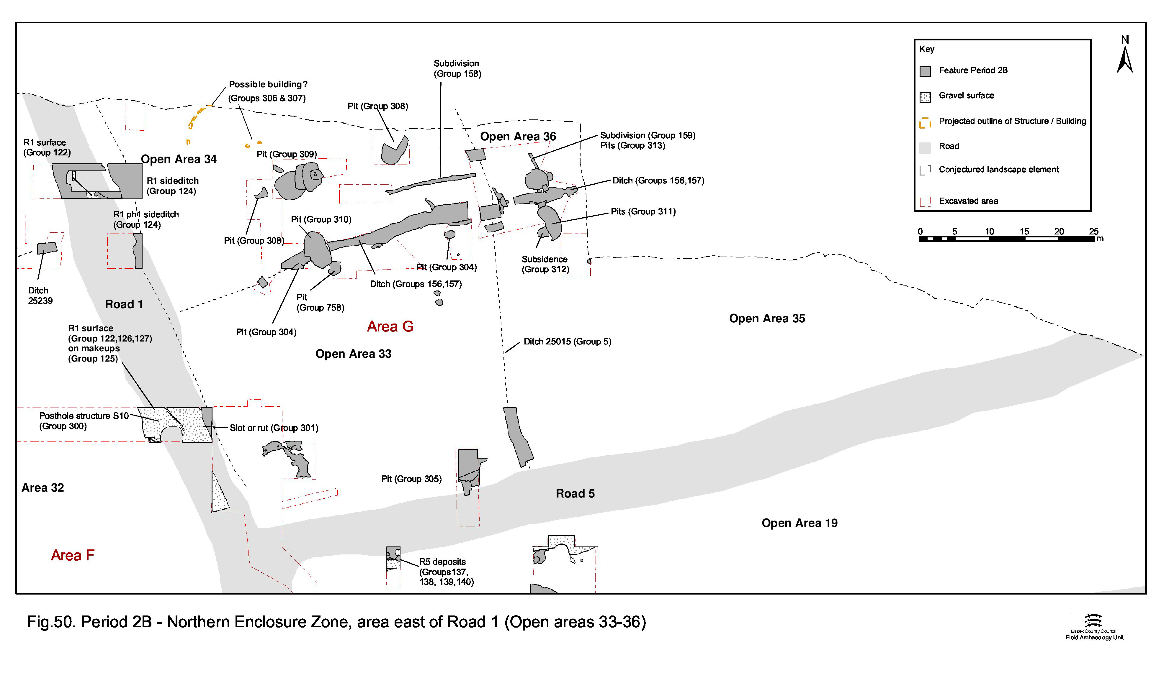
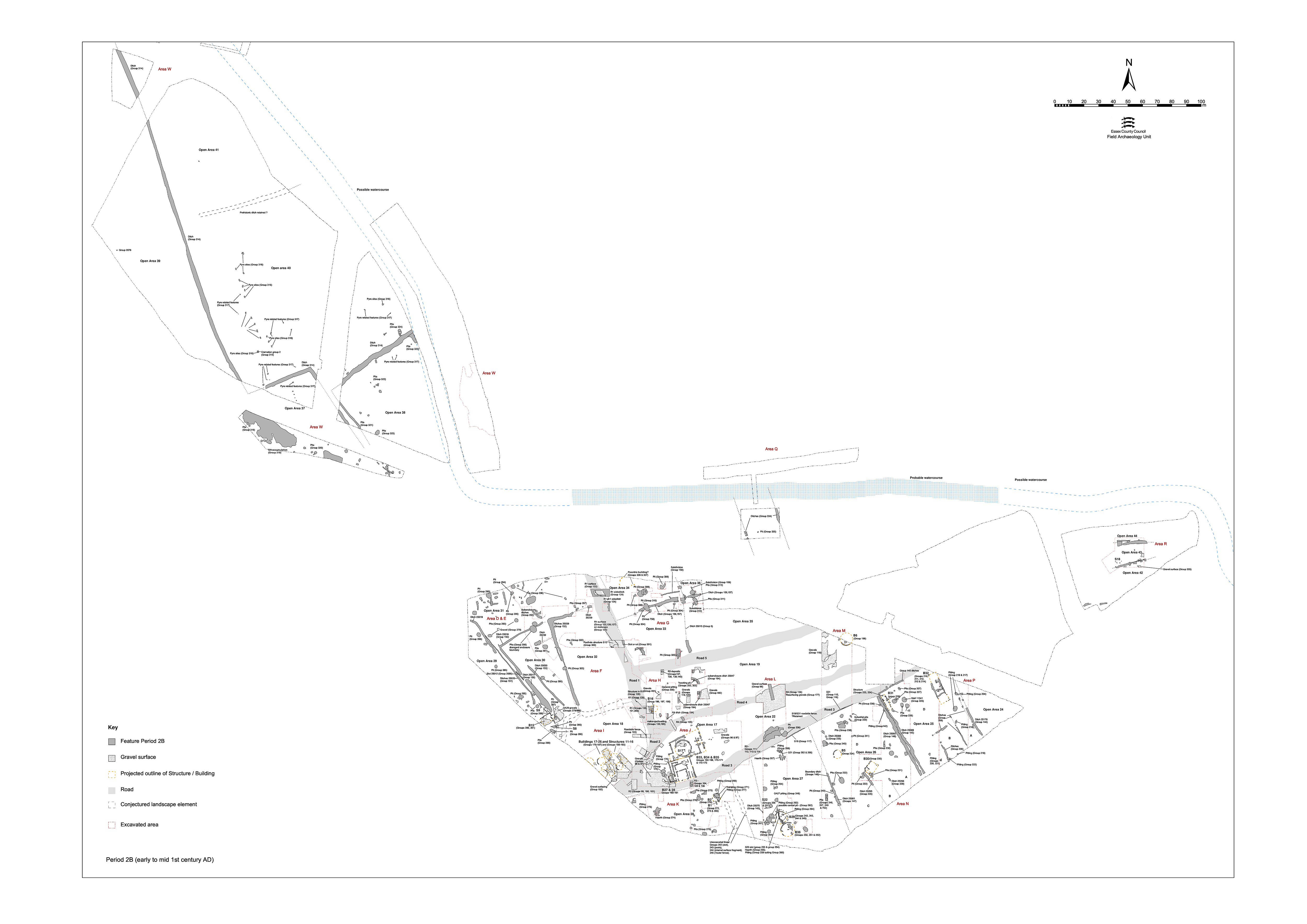
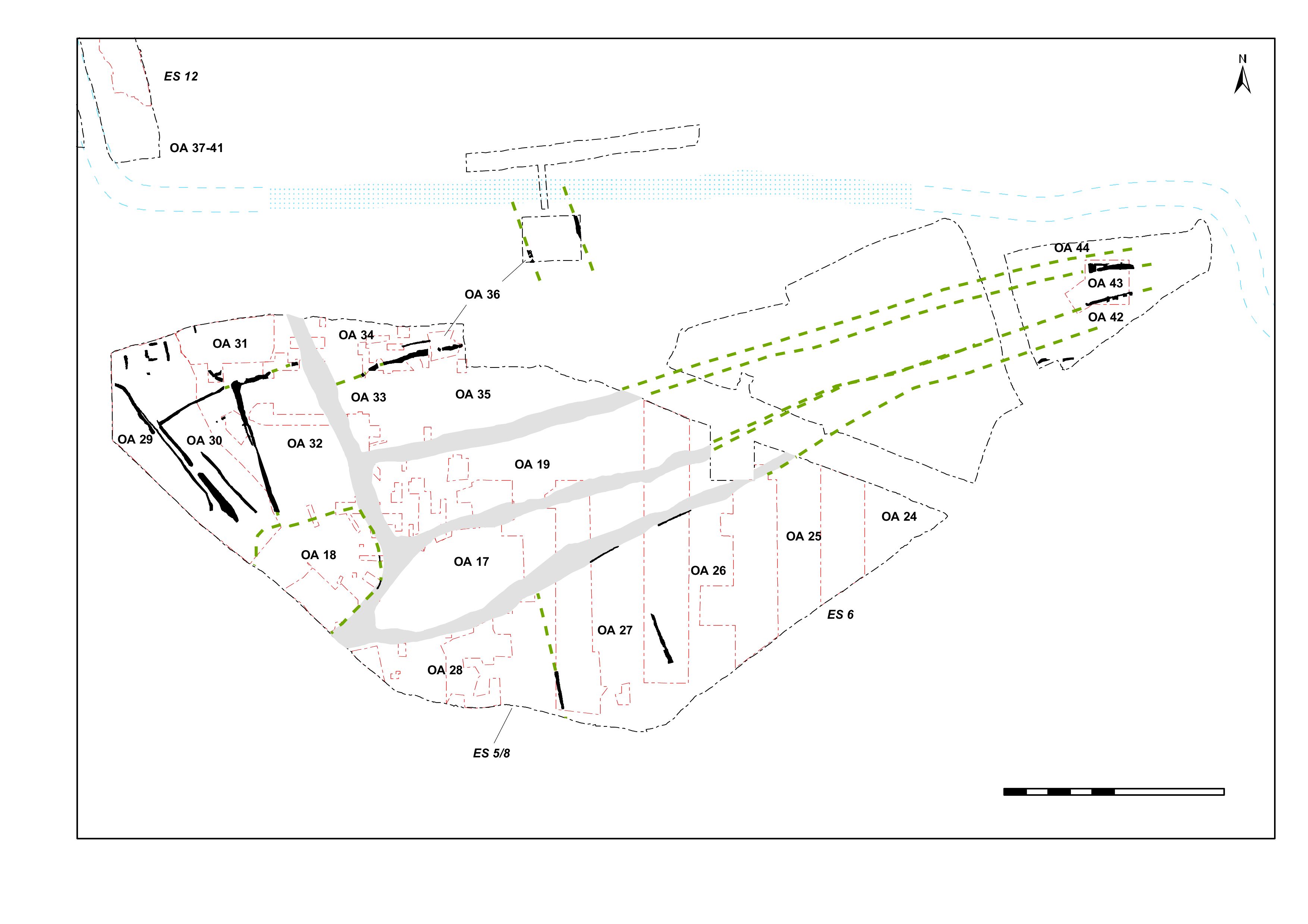
Unlike to the west of Road 1, that part of the Northern Zone to its east seems to retain some of the Period 2A landscape features into its new layout (Figure 50). The Period 2A remodelled infrastructure clearly imposes new constraints upon this part of the terrace in the form of Roads 1 and 5. The land between these and the river channel, which runs just below the upper terrace step, is seemingly divided into a series of enclosures defined by both new and old ditched boundaries. Although much of this part of the lower terrace was not investigated, parts of at least four enclosures are somewhat tentatively identified within Excavation Areas G and R. These are termed Open Areas 33 to 36. While the enclosure system itself is described here, the contents of the individual enclosures are given separately.
Ditch 25041 (segs 7132, 7196, 7200, 7225, 7227, 7231, 7236, 7246) runs broadly east-to-west, with a pronounced curve at the west end of its investigated length of c. 28m. The ditch is not recorded beyond this western point and it is uncertain if this curvature represents a wide, rounded, return or merely a meandering line. At the time of its excavation, the eastern recorded end of 25041 was thought to be cut by Period 2A ditch 25045, but the continuation of the alignment of 25041 further east, as ditch 25042, suggests that it is more likely that 25041 terminates on top of 25045.
The fills, depth, and to some extent even width and profile, of 25041 vary considerably along its length, but it is on average 2m wide and 0.75m deep, with a splayed V-shaped section. Distinct upper fills are more likely to represent accumulations within subsidence hollows than re-cuts of the ditch line. The curvature of the western part of ditch 25041 may be due to the incorporation of part of the course of earlier ditch 25044 into its line, which suggests a degree of continuity between Period 2A and 2B land divisions. Its fills contain modest assemblages of Late Iron Age pottery and loomweight fragments, but some residual Middle Iron Age and 'early' Late Iron Age pottery is also present. The accumulation within apparent slump hollows includes Roman pottery, but the ditch seems to pass out of use by the end of the Late Iron Age, as its truncation by substantial pit 7060 indicates.
Ditch 25042 (segs 7282, 7291, 7305, 7357), which continues the line of 25041 to the east of 25045, was a relatively broad but short ditch some 11m long. Measuring 1.5m wide and 0.8m deep at its middle, this cut tapers towards a rounded terminal at each end. The finds assemblage is more varied than that from 25041 and the presence of small quantities of early Roman pottery alongside Late Iron Age suggests that this feature accumulates material into the mid- to late 1st century AD.
Because ditches 25041 and 25042 apparently respect the Period 2A ditch 25045, it is likely that this earlier feature - or at least some late manifestation of the boundary it represented - is retained as a division of the revised Period 2B landscape. It is unlikely that the ditch itself survives, particularly as it is disrupted by the imposition of Road 5 across it. Perpetuation of the boundary in the form of a hedge is perhaps more likely.
Investigation of that part of Excavation Area R to the south of the watercourse revealed two short sections of parallel ditches, 12284 and 12360, on a rough NNW-SSE course. Sharing an alignment with Road 1 and containing no diagnostic artefacts, these are possibly further elements of the same enclosure system.
The northern continuation of 12284 is obscured by the overlying gravelly silt that covers much of the southern part of Area R. It was not excavated in its own right, but seems to be a ditch where cut through by Period 3 well 12245. Exposed only in the sides of this well, it is 1.8m wide and 0.22m deep. Although no dating evidence was obtained from 12284, it may reasonably be assumed to belong to the first half of the 1st century AD, passing out of use by the end of the Late Iron Age.
Although also unexcavated, ditch 12360, 23m to the east, is of similar proportion in plan, at 1.6m wide, and occupies a similar stratigraphic position being overlain by the same gravelly silt deposit.
If indeed parts of this enclosure system, they serve to demonstrate that it extends up to the edge of the watercourse.
Internet Archaeology is an open access journal based in the Department of Archaeology, University of York. Except where otherwise noted, content from this work may be used under the terms of the Creative Commons Attribution 3.0 (CC BY) Unported licence, which permits unrestricted use, distribution, and reproduction in any medium, provided that attribution to the author(s), the title of the work, the Internet Archaeology journal and the relevant URL/DOI are given.
Terms and Conditions | Legal Statements | Privacy Policy | Cookies Policy | Citing Internet Archaeology
Internet Archaeology content is preserved for the long term with the Archaeology Data Service (ROR). Help sustain and support open access publication by donating to our Open Access Archaeology Fund.