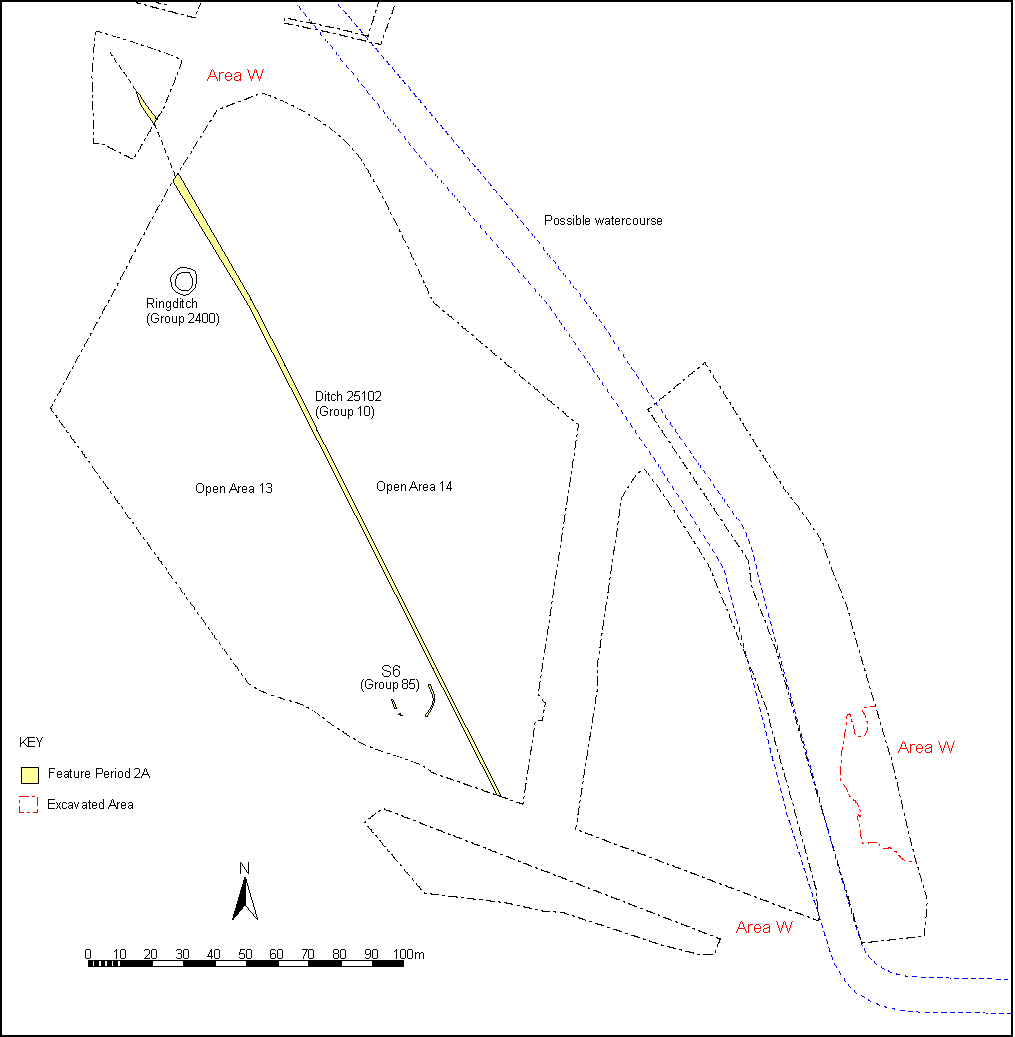
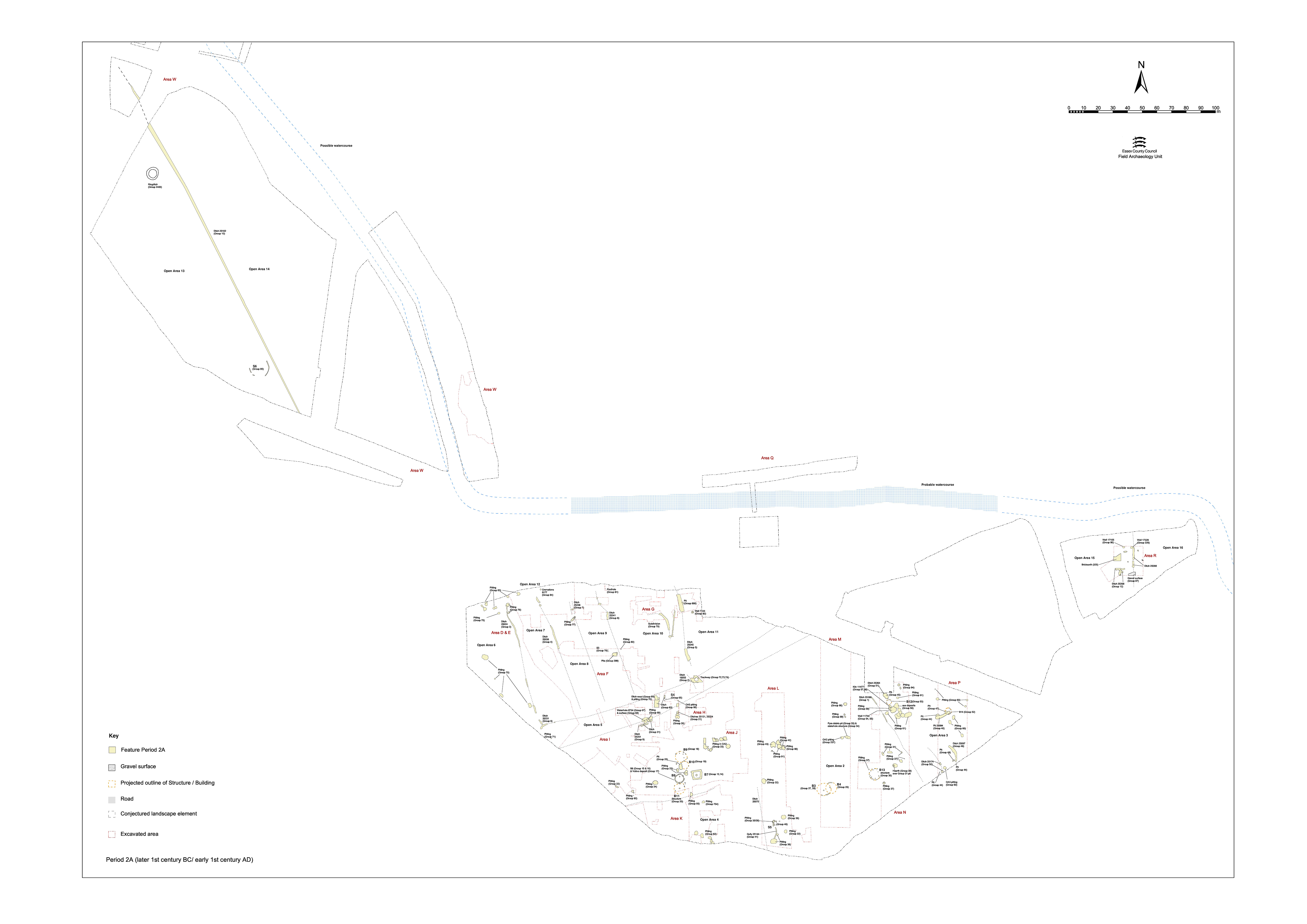
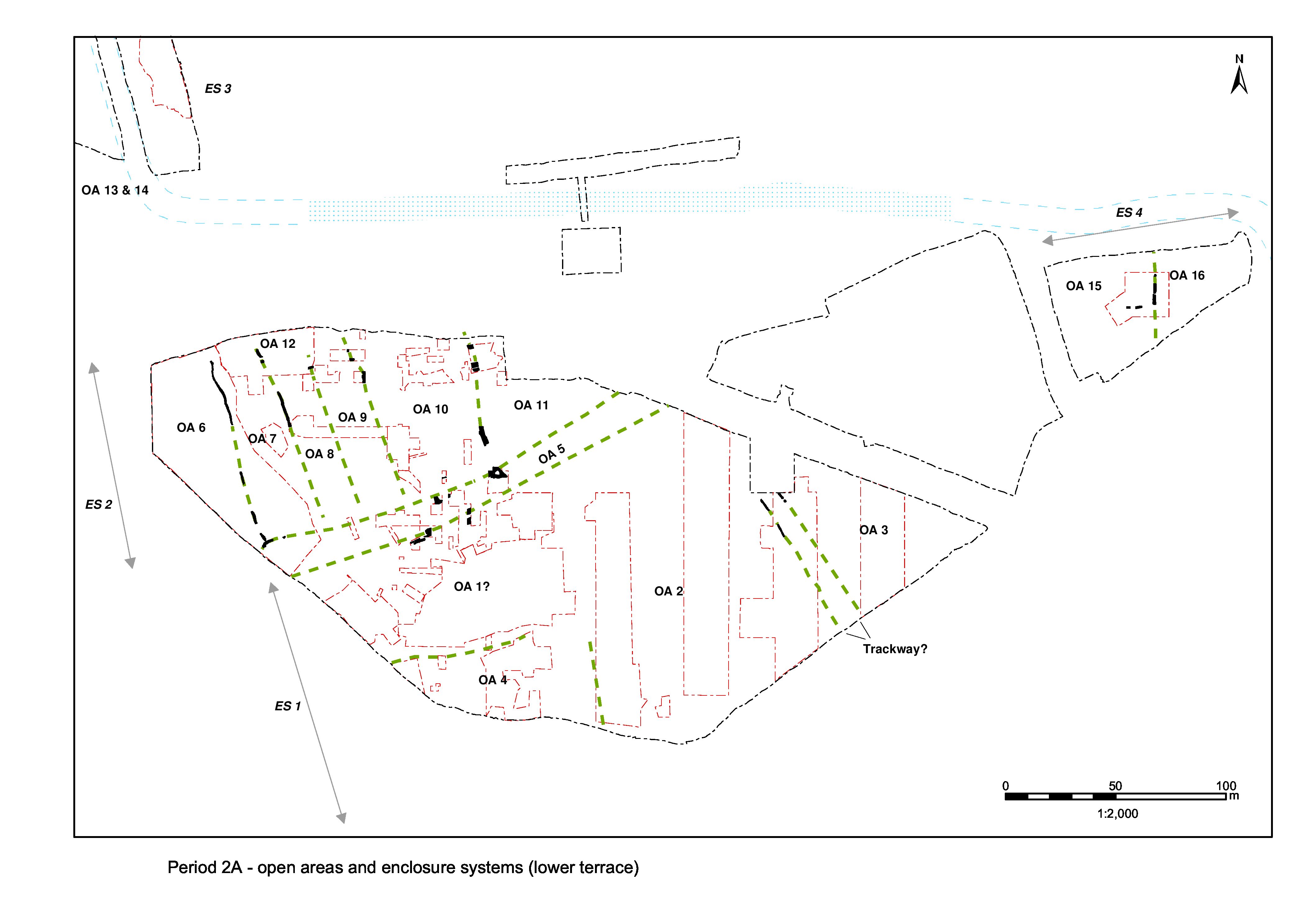
The upper gravel terrace, occupying the northern part of the overall development area, is occupied by a separate system of landscape enclosure to that of the lower terrace, presumably reflecting a distinct difference in land-use. Division of the northern hinterland area would seem to be simple and large scale; a single ditched boundary being identified within Excavation Area W, defining two basic enclosed entities (Figures 5 and 27). No division of the upper terrace further east (i.e. within Excavation Area R) is discerned in Period 2A. This Period 2A organisation clearly lays the basis for what becomes the more developed Northern Hinterland enclosure system of the Roman period settlement.
Activity within the defined enclosures, termed Open Areas 13 and 14, is described in Upper terrace.
Continuous north-west/south-east aligned ditch 25102 (segs 2004, 2265, 2459, 2464, 2477, 2553) is presumed to be imposed on the landscape some time in the late 1st century BC-early 1st century AD. Exposed over a distance of 280m, it is most substantial at its north end (seg. 2004) where it is 2.30m wide and 0.56m deep, but it is on average 1.00-1.20m wide and 0.30m deep along the greater part of its length. The southern terminal of the ditch may be presumed to coincide with the edge of the upper gravel terrace, although this was not determined by excavation. There is no indication of re-cutting or maintenance and its fills contain no artefacts, other than residual prehistoric pottery sherds (seg. 2265). It is assumed that the ditch itself is relatively short-lived.
However, the later positioning of a group of Late Iron Age pyre sites (Period 2B Group 316) on and alongside this feature, even after it becomes infilled, indicates its continued significance in the landscape until at least the earlier 1st century AD.
The ditch is considered to constitute part of the northern hinterland enclosure system and to define the boundary between Open Areas 13 and 14 (to its west and east respectively). These two large land entities are presumably bounded to the south by the terrace edge. No western or northern limits are established, though OA14 presumably only extends eastward as far as the posited northward course of the watercourse.
Internet Archaeology is an open access journal based in the Department of Archaeology, University of York. Except where otherwise noted, content from this work may be used under the terms of the Creative Commons Attribution 3.0 (CC BY) Unported licence, which permits unrestricted use, distribution, and reproduction in any medium, provided that attribution to the author(s), the title of the work, the Internet Archaeology journal and the relevant URL/DOI are given.
Terms and Conditions | Legal Statements | Privacy Policy | Cookies Policy | Citing Internet Archaeology
Internet Archaeology content is preserved for the long term with the Archaeology Data Service (ROR). Help sustain and support open access publication by donating to our Open Access Archaeology Fund.